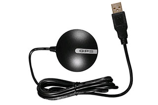
关于NMEA详细文档,请下载:
http://usglobalsat.com/store/downloads/NMEA_commands.pdf
NMEA是一种标准协议,由GPS接收器用于传输数据。 NMEA输出是EIA-422A,但对于大多数用途,您可以认为它与RS-232兼容。使用4800 BPS,8个数据位,无奇偶校验和一个停止位(8N1)。 NMEA 0183句子都是ASCII。每个句子以美元符号($)开头,以回车换行(<CR> <LF>)结束。数据以逗号分隔。必须包含所有逗号,因为它们充当标记。有些GPS不会发送一些字段。可选地添加校验和(在少数情况下它是强制性的)。 $之后是地址字段aaccc。 aa是设备ID。 GP用于识别GPS数据。设备ID的传输通常是可选的。 ccc是句子格式化程序,也称为句子名称。 BRIDGE阅读以下句子。
NMEA 0183信号
以下是Marimsys BRIDGE系统支持的NMEA消息列表:
DBT
$IIDBT,6,f,1,mt,1,F <CR><LF> (Depth below Transducer)
1 = depth
2 = foot
3 = depth
4 = meter
5 = fathoms
6 = depth
GGA
$GPGGA,hhmmss.ss,llll.ll,a,yyyyy.yy,a,x,xx,x.x,x.x,M,x.x,M,x.x,xxxx*hh
GGA = Global Positioning System Fix Data
1 = UTC of Position
2 = Latitude
3 = N or S
4 = Longitude
5 = E or W
6 = GPS quality indicator (0=invalid; 1=GPS fix; 2=Diff. GPS fix)
7 = Number of satellites in use [not those in view]
8 = Horizontal dilution of position
9 = Antenna altitude above/below mean sea level (geoid)
10 = Meters (Antenna height unit)
11 = Geoidal separation (Diff. between WGS-84 earth ellipsoid and mean sea level. -=geoid is below WGS-84 ellipsoid)
12 = Meters (Units of geoidal separation)
13 = Age in seconds since last update from diff. reference station
14 = Diff. reference station ID#
15 = Checksum
GSA
$GPGSA,A,3,19,28,14,18,27,22,31,39,,,,,1.7,1.0,1.3*35
GSA = GPS receiver operating mode, SVs used for navigation, and DOP values.
1 = Mode:M =Manual, forced to operate in 2D or 3D A =Automatic, 3D/2D
2 = Mode:
1 =Fix not available
2 =2D
3 =3D
3-14 = IDs of SVs used in position fix (null for unused fields)
15 = PDOP
16 = HDOP
17 = VDOP
GSV
$GPGSV,4,1,13,02,02,213,,03,-3,000,,11,00,121,,14,13,172,05*67
GSV = Number of SVs in view, PRN numbers, elevation, azimuth & SNR values.
1 = Total number of messages of this type in this cycle
2 = Message number
3 = Total number of SVs in view
4 = SV PRN number
5 = Elevation in degrees, 90 maximum
6 = Azimuth, degrees from true north, 000 to 359
7 = SNR, 00-99 dB (null when not tracking)
8-11 = Information about second SV, same as field 4-7
12-15 = Information about third SV, same as field 4-7
16-19 = Information about fourth SV, same as field 4-7
HSC
$IIHSC17,C,38,m <CR><LF> (Temperature Submerged - Celsius)
1 = temperature
2 = temperature character
3 = depth of reading
4 = meters
MTW
$IIMTW,17,c<CR><LF> Mean Temperature of Water
1 = temperature : string[ 5 ];
2 = Celsius : char;
RMA
$GPRMA,A,llll.ll,N,lllll.ll,W,,,ss.s,ccc,vv.v,W*hh
RMA = Navigation data from present position
1 = Data status
2 = Latitude
3 = N/S
4 = longitude
5 = W/E
6 = not used
7 = not used
8 = Speed over ground in knots
9 = Course over ground
10 = Variation
11 = Direction of variation E/W
12 = Checksum
RMB
$GPRMB,A,x.x,a,c—c,d—d,llll.ll,e,yyyyy.yy,f,g.g,h.h,i.i,j*kk
RMB = Recommended Minimum Navigation Information
1 = Data Status (V=navigation receiver warning)
2 = Crosstrack error in nautical miles
3 = Direction to steer (L or R) to correct error
4 = buycbdproducts Waypoint ID#
5 = Destination Waypoint ID#
6 = Destination Waypoint latitude
7 = N or S
8 = Destination Waypoint longitude
9 = E or W
10 = Range to destination in nautical miles
11 = Bearing to destination, degrees True
12 = Destination closing velocity in knots
13 = Arrival status; (A=entered or perpendicular passed)
14 = Checksum
RMC
$GPRMC,hhmmss.ss,A,llll.ll,a,yyyyy.yy,a,x.x,x.x,ddmmyy,x.x,a*hh
RMC = Recommended Minimum Specific GPS/TRANSIT Data
1 = UTC of position fix
2 = Data status (V=navigation receiver warning)
3 = Latitude of fix
4 = N or S
5 = Longitude of fix
6 = E or W
7 = Speed over ground in knots
8 = Track made good in degrees True
9 = UT date
10 = Magnetic variation degrees (Easterly var. subtracts from true course)
11 = E or W
12 = Checksum
VHW
$IIVHW17,c,32,m,4.1,K,3,k
1 = temperature
2 = units of temperature
3 = depth of reading
4 = meters of depth
5 = velocity of knotmeter
6 = knots
7 = velocity of knotmeter
8 = km
VTG
$GPVTG,t,T,,,s.ss,N,s.ss,K*hh
VTG = Actual track made good and speed over ground
1 = Track made good
2 = Fixed text ‘T’ indicates that track made good is relative to true north
3 = not used
4 = not used
5 = Speed over ground in knots
6 = Fixed text ‘N’ indicates that speed over ground in knots
7 = Speed over ground in kilometres/hour
8 = Fixed text ‘K’ indicates that speed over ground is in kilometres/hour
9 = Checksum
TPR
@IITPR,x,M,y,P,z.z,M
TPR = Trawl Position Relative Vessel
1 = Horizontal range relative to target
2 = Meters (0 - 4000M)
3 = Bearing to the Target, relative to the vessel heading. Resolution is one degree.
4 = Separator.
5 = Depth of trawl below the surface
6 = Meters (0 - 2,000)
HFB
@IIHFB,x.x,M,y.y,M
HFB = Trawl Headrope to Footrope and Bottom
1 = Distance from headrope to footrope
2 = Meters (0-100)
3 = Distance from the headrope to bottom
4 = Meters (0-100)
TDS
@IITDS,x.x,M
TDS = Trawl Door Spread distance
1 = Distance between trawl doors
2 = Meters (0-300)
ITS
@IITS,x.x,M
TS2 = Trawl Door Spread 2 distance
1 = Second spread distance
2 = Meters
TFI
@IITFI,x,y,z
TFI = Catch sensors to represent trawl filling
x = Catch sensor #1 (0 = off, 1 = on, 2 = no answer)
y = Catch sensor #2 (0 = off, 1 = on, 2 = no answer)
z = Catch sensor #3 (0 = off, 1 = on, 2 = no answer)
TPT
@IITPT,x,M,y,P,z.z,M
TPT = Trawl Position True relative to the vessel
1 = Horizontal distance from the vessel center line. Value is positive if trawl is to starboard, negative if the trawl is to port.
2 = Meters
3 = Horizontal distance from the transducer to the trawl along the vessel center line. The value is normally positive assuming the trawl is located behind the vessel.
4 = Meters
5 = Depth of the trawl below the surface. The value is normally positive, assuming the trawl is located below the ocean surface.
6 = Meters
TTM
$--TTM,xx,x.x,x.x,a,x.x,x.x,a,x.x,x.x,a,c--c,a,a,hhmmss.ss,a*hh
TTM = Tracked target message (ARPA Radar only)
1 = Target number, (00 - 99)
2 = Target distance from own ship
3 = Bearing from own ship
4 = Target bearing is T / R (True / Relative)
5 = Target Speed
6 = Target Course
7 = Target course is T / R (True / Relative)
8 = Distance of Closest Point of Approach (CPA)
9 = Time to CPA in minutes, positive is approaching target, ( - ) negative is moving away.
10 = Speed / Distance units K / N / S (Kilometers / Knots / Statute miles)
11 = User data - generally target name
12 = Target Status L / Q / T (Lost from tracking process / Query - in process of acquisition / Tracking at the present time)
13 = Reference target = R, null otherwise
14 = Time of data in UTC format (hhmmss.ss)
15 = Type of target acquisition A / M (Automatic / Manual)
16 = Checksum
TPT
@IITPT,x,M,y,P,z.z,M<cr><lf>
TPT Trawl Position True vessel.
x,M Horizontal range to the target (0 - 4000m).
y,P True bearing to the target (i.e. relative north). The resolution is l degree.
z.z,M Depth of trawl below the surface (0 -2000m).
As with to the TPR message, the difference is the bearing to the trawl.
TPC
@IITPC,x,M,y,M,z,M<cr><lf>
TPC Trawl Position Cartesian Coordinates.
x Horizontal distance from vessel center line. Value is positive if trawl is on the starboard side, negative on port side.
y Horizontal distance from transducer to trawl in center line direction. Value is normally positive.
z Depth from surface to trawl. Value is normally positive.
GLL
$IIGLL,ddmm.hh,N,dddmm.hh,W<cr><lf>
GLL Trawl’s Geographical Latitude and Longitude
ddmm.hh,N Latitude Deg.Min.Hundredths N=North, S=South lat.
dddmm.hh,W Longitude Deg.Min.Hundredths,W=West, E=East long.
DBS
$IIDBS,,,x.x,M,,<cr><lf>
DBS Depth Below Surface.
x.x Depth in meter (0 - 2000).
The fields for depth in feet and fathoms are empty.
MTW
$IIMTW,-xx.xx,C<cr><lf>
MTW Meteorological Temperature in Water.
xx.x Water temperature (°C) measured at the trawl. (Sign prefix only if minus). Range from -5°C to + 30°C.
C Celsius degrees.
HFB
@IIHFB,x.x,M,y.y,M<cr><lf>
HFB Headrope to Footrope and Bottom.
x.x,M Distance from headrope to footrope (0 - 100m).
y.y,M Distance from headrope to bottom (0 - 100m).
TDS
@IITDS,x.x,M<cr><lf>
TDS Trawl Door Spread
x.x,M Spread distance in meters (0 - 300m).


您可以选择一种方式赞助本站
支付宝扫一扫赞助
微信钱包扫描赞助